The Book

Te Wai Pounamu Revisited, cover

I didn’t know whether I would survive this long, but finally the book is there. Grab a copy at hugendubel for €29.99 postage-free while you can, or the printers epubli for €29.99 plus postage. Plenty of color photos specifically brightened, contrasted and gammaed for the print medium. I hope you enjoy. Read more…

A Countdown

Apart from the never-ending – or never wanting to end – question of which brand of roaming chip you should buy for your mobile phone, the second most popular question on the various forums that I visit is, “Do I need to book in advance?” Probably the most annoying feature of this question is that a general answer seems to be required, and that is not possible without very detailed knowledge of what the petitioner expects to do.

There are some activities, places and times that require booking at the earliest possibility – Queenstown between Christmas and the New Year (but that has always been the case, even since 1974), the Milford Track (and, increasingly the Routeburn and Kepler Tracks as well) – because they will be booked out very quickly. This is not to rule out the possibility of getting a single place on the Great Walks at short notice – that has been possible in recent years. But that would require a sort of flexibility that few travellers have. Read more…

Debriefing: Queen Charlotte Sound

Different means of travel, different speeds. This sort of put trip planning off a little. On the other hand, not having to spend a whole day slogging on towards some distant goal had its benefits, not least of which was enjoying the scenery. More could have, should have been done, but I’ll happily leave that for another time.

Section (with links) Distance Track Time Break Mean speed Median time|distance
Picton – Mistletoe Bay 19.4 km 3:26 h 2:14 h 5.65 km/h 6.53|6.76 km/h
Mistletoe Bay – Kumutoto Bay 19.9 km 3:44 h 2:54 h 5.35 km/h 5.74|6.18 km/h
Kumutoto Bay – Blumine Island 21.9 km 3:42 h 1:34 h 5.94 km/h 6.60|6.73 km/h
Blumine Island – Cannibal Cove 16.3 km 2:46 h 1:21 h 5.92 km/h 6.55|6.68 km/h
Cannibal Cove – Ship Cove 7.8 km 1:34 h 0:54 h 4.99 km/h 6.04|6.29 km/h
Totals 85.5 km 15:20 h 8:49 h 5.57 km/h 6.35|6.57 km/h
Summary of paddling the Queen Charlotte Track
Way to go: Speed distribution by time, Queen Charlotte Sound

The boat was no doubt fast (and special thanks again to Marlborough Sounds Adventures for a very reasonably priced 5-day hire and return transport – $240 per person), possibly due to the fact that it was not packed to the hilt. A later trip in western Sweden using plastic boats and carrying all supplies for twelve days proved to be somewhat slower. Read more…

Debriefing: Wangapeka Track

This was one of the more enjoyable options of returning from the Heaphy Track, by as direct a means as possible, and as such is one of the classical combination routes. With accommodation and the supermarket in Karamea, this was also an ideal way of doing a much longer hike than would otherwise be possible.

Section (with links) Distance Track Time Break Mean speed Median time|distance Ascent Descent
Little Wanganui Road End – Taipo 20.3 km 6:56 h 0:47 h 2.93 km/h 2.74|3.66 km/h 1475 m (M+) 835 m (M+)
Taipo – Stone 18.6 km 6:09 h 0:40 h 3.03 km/h 3.12|3.52 km/h 889 m (M) 911 m (M)
Stone – Price’s Clearing 19.7 km 4:56 h 0:40 h 4.00 km/h 4.21|4.51 km/h 646 m (M-) 1033 m (M)
Totals 58.7 km 18:02 h 2:07 h 3.25 km/h 3.29|3.93 km/h 3000 m (M) 2772 m (M)
Summary of the Wangapeka Track. Climb categories are: Flat (< 1.9°/3.3%), Easy (> 1.9°/3.3%), Moderate (> 3.8°/6.6%), Demanding (> 7.5°/13%, < 15°/27%)
Wangapeka Track, speed distribution by time

The only thing that was worrying about the track was the fact that it had been reclassified as a “route” from previously being a track. This means that upkeep of the track is downgraded, and any further slips, etc. which might impede progress will no longer be bypassed (as was the case near the Karamea end, where recent windfall has almost obliterated the track, but temporary signs have been erected to allow passage, and shortly before Wangapeka Saddle, where a detour around a major slip was well signed). This has meant that a telephone once present at the Karamea end of the track has been removed, although the telephone at Price’s Clearing was still there. These telephones provide (or provided) a secure means of arranging transport off the track at both ends. For alternative accommodation right at the Karamea end of the track, Atawhai Farmstay is a possibility (and they have a phone there as well).
Read more…

Debriefing: Karamea

Faced with almost immediately getting on a bus at the end of the Heaphy Track at Kohaihai, and arriving some time in the evening back in Nelson, or even taking the fast track by flying back from Karamea airfield to Nelson, I decided on a couple of days in Karamea. This is not an easy place to get to, or one that most people even get to, but I was wanting to return by hiking almost directly back in the direction of Nelson via the Wangapeka Track, and needed just two days to have a shower, wash the hiking gear, and replenish supplies before heading off again.

That was the underestimation of the trip. Karamea might be at the end of the longest cul-de-sac in the world, but that might just make it one of the last “hidden gems” from the hordes of tourists trampling down nearly everything else. I only wished that I had had at least another day (and as it turned out, I did the Wangapeka Track in a day less than I had planned, so I could have stayed that extra day). Read more…

Debriefing: Heaphy Track

With just over 71 km, the Heaphy Track is the longest of the pedestrian Great Walks, and I use the word “pedestrian” advisedly, because the Whanganui River Journey, a Great Walk that can only be done by kayak/canoe, is twice as long, and the Heaphy is open for pedestrians only in the Great Walks Season (November – April). In the winter time it is a mountain bike track, so be warned.

Section (with links) Distance Track Time Break Mean speed Median time|distance Ascent Descent
Brown Hut Access – Perry Saddle 16.0 km 4:09 h 0:25 h 3.87 km/h 4.14|4.39 km/h 1408 m (D-) 670 m (M+)
Perry Saddle – James Mackay 21.3 km 5:04 h 1:49 h 4.21 km/h 4.47|4.67 km/h 609 m (M-) 778 m (E+)
James Mackay – Heaphy Hut 18.2 km 4:17 h 1:12 h 4.25 km/h 4.64|4.88 km/h 341 m (E+) 1033 m (M)
Heaphy Hut – Kohaihai Carpark 15.6 km 3:35 h 0:23 h 4.36 km/h 4.79|5.09 km/h 504 m (E+) 508 m (M-)
Totals 71.1 km 17:05 h 3:49 h 4.17 km/h 4.47|4.72 km/h 2892 m (M) 3020 m (M-)
Summary of the Heaphy Track. Climb categories are: Flat (< 1.9°/3.3%), Easy (> 1.9°/3.3%), Moderate (> 3.8°/6.6%), Demanding (> 7.5°/13%, < 15°/27%)

Heaphy Track speed distribution by time
Heaphy Track speed distribution by time, in this case 75% of the time spent on the track was at faster than 3.6 km/h
However, the nature of the walk is very much determined by its dual purpose as a tramping/biking track. The major ascent – from the Brown Hut access in the Brown Valley to Perry Saddle Hut – barely just qualifies as being “D-”, and for the most part it is a comparatively gentle climb netting 830 m. The major descent from James Mackay to Heaphy Huts netts just on 700 m. Not only are the slopes much gentler than, say, the Dusky Track, but the path itself is for the most part well-formed and there is very little mud to wade through. And the speed distribution confirms it: 75% of the time on the Heaphy Track was traversed at speeds greater than 3.6 km/h. And I like to think that the daily increase in speed of around 0.1 km/h was due to progressive lightening of the pack… Read more…

Debriefing: Dusky Track

If there was one word for this track, it would be “tough”, t, o, u g, h. It’s not just the two alpine passes that have to be conquered, nor the mud, nor even finding the track. It must be one of the toughest walks I’ve ever done. It’s pretty slow going at best, as the table shows, and the climbs and downclimbs reach an average grade of D+, which is between 7.5° and 15° on average for the distance of the climb. On average.

Section Distance Track Time Break Mean speed Median time|distance Ascent Descent
Lake Hauroko – Halfway Hut 11.9 km 4:35 h 0:08 h 2.60 km/h 2.47|3.05 km/h 444 m (M-) 279 m (E+)
Halfway Hut – Lake Roe 7.8 km 3:58 h 0:07 h 1.95 km/h 1.77|2.42 km/h 643 m (M+) 106 m (E)
Lake Roe – Loch Maree 8.6 km 4:19 h 0:44 h 1.98 km/h 1.92|2.39 km/h 419 m (D-) 1245 m (D+)
Loch Maree – Supper Cove 15.0 km 6:39 h 1:04 h 2.25 km/h 2.06|2.78 km/h 505 m (M-) 552 m (M-)
Supper Cove – Loch Maree 14.1 km 5:59 h 0:55 h 2.36 km/h 2.21|2.90 km/h 506 m (E+) 452 m (M-)
Loch Maree – Kintail 11.3 km 5:22 h 1:02 h 2.11 km/h 2.01|2.60 km/h 563 m (M) 341 m (M-)
Kintail – Upper Spey 7.1 km 4:26 h 1:47 h 1.60 km/h 1.48|1.86 km/h 833 m (D+) 652 m (D)
Upper Spey – West Arm 13.5 km 4:39 h 0:12 h 2.90 km/h 2.71|3.81 km/h 275 m (E) 547 m (M-)
Totals 89.3 km 39:58 h 6:20 h 2.23 km/h 2.04|2.68 km/h 4145 m (M) 4134 m (M)
Summary of the Dusky Track. Climb categories are: Flat (< 1.9°/3.3%), Easy (> 1.9°/3.3%), Moderate (> 3.8°/6.6%), Demanding (> 7.5°/13%), Strenuous (> 15°/27%)

Two big hills: On the left the climb up to Furkert Pass and the descent into Loch Maree; on the right the climb over Centre Pass

What was left of the boots. Repair to the boot on the left (rivet) was post-Dusky; later the eyelet below also tore; eyelets on the other boot show critical frying , as well as other damage
What was left of the boots. Repair to the boot on the left (rivet) was post-Dusky; later the eyelet below also tore; eyelets on the other boot show critical fraying, as well as other damage
So my advice for most people is not to try taking two stages at a time. Quite possibly the only section that might be done like this is from Hauroko Burn all the way up to Lake Roe, but the starting time is late, and the track, which is initially quite good, rapidly deteriorates. Read more…

Debriefing: Stewart Island

Granted: The short stay on Stewart Island was designed for a kayak-in/kayak-out version of the Southern Circuit in five days:

  • Oban, Golden Bay – Rakeahua Hut (kayak, pick up by water taxi in the evening)
  • Rakeahua Hut – Doughboy Bay
  • Doughboy Bay – Mason Bay
  • Mason Bay – Freshwater
  • Freshwater – Oban, Golden Bay (kayak, delivery in the morning).

Whether or not that would have been realistic – especially from the kayaking side – is another question. The tides were right, but not spending a day on the water getting to Rakeahua would have meant hanging around a whole day for the water taxi to take me there.

Topo Map with GPS

Still plenty to explore: The land, and the sea
Still plenty to explore: The land, and the sea. Stewart Island: Oban – Mason Bay, Topo+GPS (4338 downloads)
In any case, having no partner for either kayaking arm meant doing a trip out to Mason Bay on foot, even if the last leg of the return journey could be undertaken by water taxi. Read more…

Bye-bye, Amazon!

For a long time I’ve relied on Amazon to find stuff, compare prices, look for bargains, and for a long time they’ve been a reliable source of all things related to travelling. I’ve put together various contraptions to help with photography, I’ve bought boots, raincoats, tents, sleeping mats, inflatable pillows and diverse kit from them. If I didn’t like the stuff, I sent it back for free. They have everything and can deliver free from China. Everything … except common sense and regard for their customers.

In the end three things got me:

  • The absolute trash that is becoming daily fare – not only in terms of trash goods, but also in terms of trash descriptions – I simply will not buy anything that looks like the description came directly out of a machine translating from Chinese and/or German;
  • Writing reviews for Amazon is a pointless task; and
  • Trying to get even a well-intentioned review published once it gets caught in Amazon’s censorship “algorithm” is also pointless.

Let me go into some detail.

Read more…

Debriefing: Satellite Tours

An additional degree of freedom when travelling was the use of “satellite tours” where a stop would be used as a starting point for a longer tour, with an intermediate base. This meant carrying less luggage to the intermediate point, but it also required a good deal of planning and organisation.

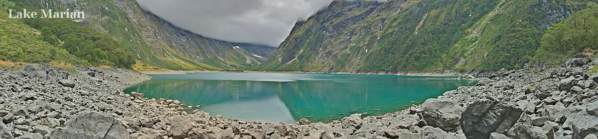
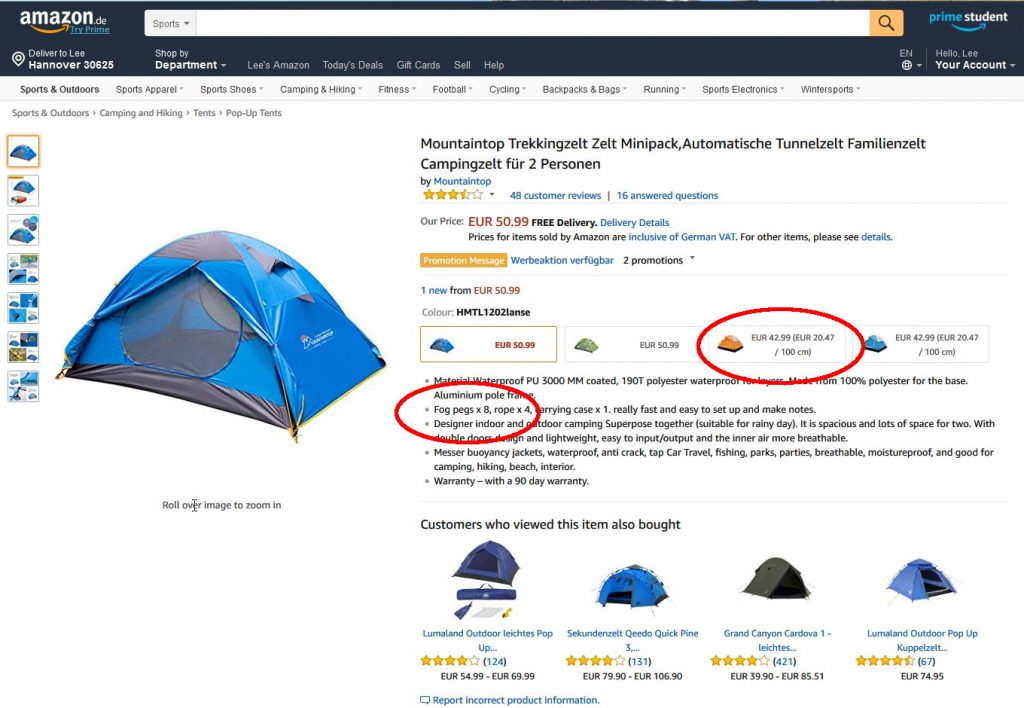
A classical tour, such as the Dusky Track, required only a place to leave most of the luggage, while taking only what was absolutely necessary (for eight days!) on the tour. Since the starting point was Te Anau, and most accommodation hosts there are used to dealing with tourists going on longer or shorter tours, then it was just a question of asking whether storage facilities were available. At Steamers Beach/Lakeview Holiday Park, a vehicle can be parked safely for $10, and another $10 will get you a locker for as long as you need it. Everything else was packed into the backpack weighing in @ 18 kg for the tour.

The first real satellite tour, however, had already been undertaken on Stewart Island. Here the idea was to spend one night in the secondary base at Oban before beginning and after ending the tramp across the island. This would mean leaving a small bag with some fresh clothes at the hostel in Oban, as well as leaving the main suitcase in Invercargill. As there is a strict weight limit on luggage on the plane (15 kg) some of the tramping food would have to be bought in Oban (not much more expensive than the mainland, but anyhow). And this is how it went: Read more…


css.php