Category Archives: Travel Planning

The Book

Journey to Te-Ika-a-Maui Cover

Update May 2023

About time to make some money off this, so please go to a book store (in real or online) to order the book: Buy Now (EPUB) or Buy Now (AZW3) as an e-book for €9.00 or on paper for €36.99. Thanks.

Update May 2018

The book is there again! After much gnashing of teeth etc I decided to go with epubli in the final analysis, because their binding was much better. All the spelling mistakes have been corrected, and all the images were “recast”, i.e. using a new technique which I am calling gtx. This attempts to automatically adjust the gamma to a midpoint of around 0.5 on one clone of the image, does the contrast/saturation intensifier and advanced tone mapping on another, then it is left up to me to mix the two images and adjust the gamma again to around 0.5. Most pictures are now much brighter on the computer screen than is comfortable, but seeing them printed in trial runs leads me to believe that a gamma midpoint of 0.55 wouldn’t have hurt either. Anyway the result is viewable. The book is also available from Hugendubel, or Thalia. Several new pictures, several pictures printed in a larger size, and a few extra pages, all for €36.99. Read more…

Epilogue: Maps…

On topographical and geodetic maps, and PHP and JavaScript scripts for converting between the two

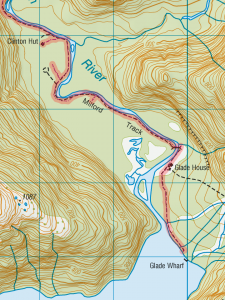
First day of the Milford Track
First day of the Milford Track. Buy the Milford Track Great Walk Topo Set (2013) – €5

I’ve occasionally said in jest that the earth is flat, at least for the purposes of drawing small scaled maps, such as those that appear in the pages of this blog.

But what I’ve somehow missed up until now is that there are two types of flatness.

For everyone with a GPS machine, let’s see what you have got and what you are missing. Your machine will produce degrees east or west of the meridian and north or south of the equator. That’s called geodetic data, and it’s fine. That’s what the elevation data produced by the SRTM (Shuttle Radar Topography Mission) are mapped out as, it’s the data that GEOrgET works with.

But it’s not the data that mapmakers express themselves in. They deal in things called Transverse Mercator projections, and they function a little differently from taking one “square degree” and squishing it into approximately its physical dimensions. Starting from a reference longitude (the north-south line), they branch off at various latitudes, initially directly to the east or west and map out a rectangular grid. Can you see what is going to be off kilter here? The further south you go, the more the line you are following, the tangent (to the east or west) will deviate southwards from the arc of the latitude. In the same way true north starts to deviate (in the Southern Hemisphere) to the east or west corresponding to how far east or west of the reference longitude you are. Read more…

Epilogue: Introducing GEOrgET 1.0

Georget_large
GEOrgET 1.0, new 3D logo

By now the maps and charts derived from the GPS tracks that I’ve recorded have become part and parcel of the blog. The software responsible for this is GEOrgET (GoogleEarth Organiser, Editor & Toolkit). However, with the gradual publication of 1 arc second elevation data, it was time to have another look at the program to see if the greater resolution was worth accommodating.

Three areas needed reviewing: The first was cosmetic – the logos and how the program looked and felt; the second was introducing the 1 arc second data and adapting the program accordingly; and the third was the under-the-hood question of the coding.

The cosmetic improvements included the new 3D logos which were fun to design and implement. Then the program handling had to be addressed. Directory and file selection are now achieved with a single click which automatically reloads the page; and to avoid clutter the latest version of multi-version files is only ever shown, and non-editable files are never shown. Read more…

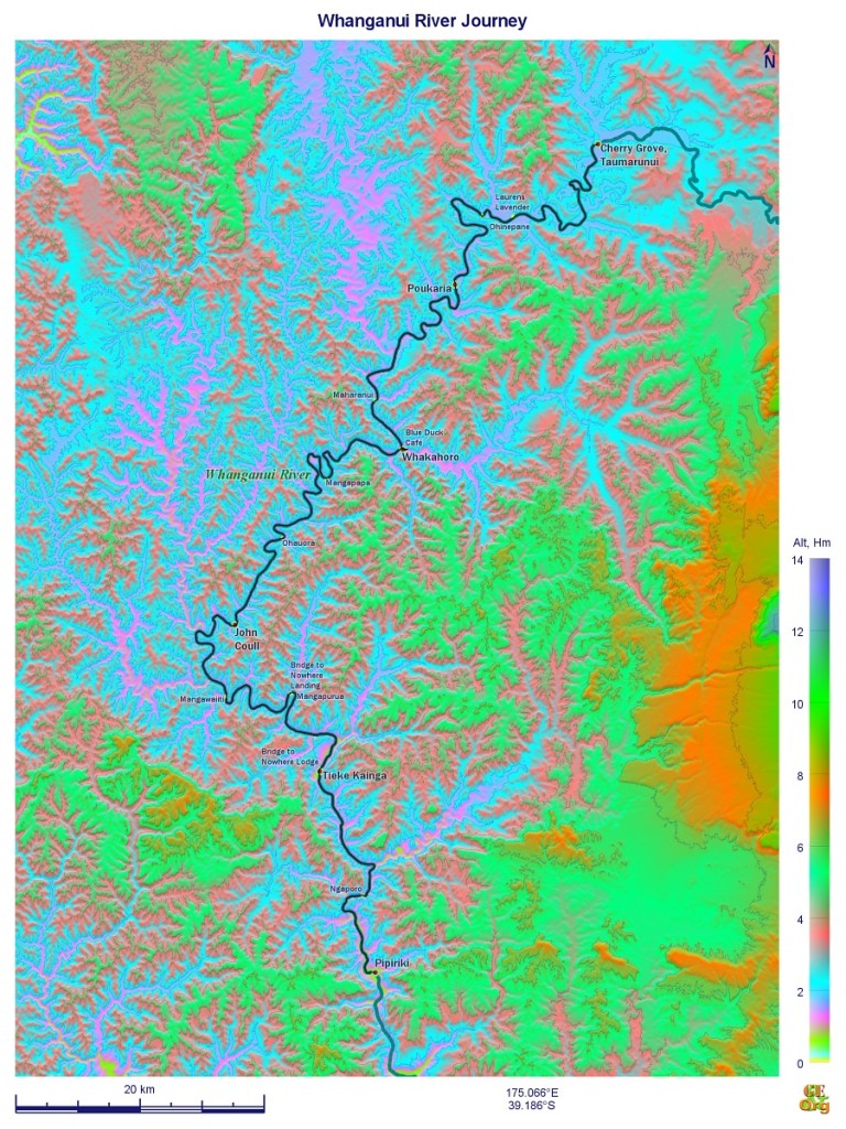
Epilogue: Debriefing the Great Walks – Whanganui River Journey

Index

I’ve dealt with the kayak operators in the previous blog, now’s the time to look at my (our) side of things.

Travel Planning

Whanganui River Journey
Buy Whanganui River Journey GPS track here for €5
Although the general suggestion is to do either Taumarunui to Pipiriki (150 km) in five days or start further down the river at Whakahoro and do the trip in three days, these are very condensed trips with little room for error. I think the worst mistake made was to schedule the first overnight stop in Poukaria.

The big problem here is that leaving Cherry Grove just after 11:00 for a 36 km leg is just too much for one day. The kayaking alone takes a good five hours, so only two rather restricted stops could be scheduled in order to get to Poukaria by dusk. Also, this is the roughest part of the whole trip, with at least two major rapids, the result of which is that everything is wet, and Poukaria Campsite lies so close to the river that overnight drying of kit is impossible.

A much better strategy would have been to schedule the stopover in Ohinepane (22 km), after taking at least one full lunch break beforehand, and an afternoon stop at Laurens Lavender (1381 River Rd, Aukopae 3991, laurenslavender.com, signposted on the river) for a cuppa and a slice of cake. This would mean a mid afternoon arrival at the campsite, after which everything could be dried, the dry bags repacked, etc. The following day Whakahoro could be reached after 35 km – again about five hours of paddling – but this time with a departure at around 9:00 (or even earlier) and two breaks along the way and arrival at the campsite by around 4:00 which seems realistic. Here again I would make better use of the Blue Duck Café (blueduckstation.co.nz, evening meals by prior arrangement) here to get some fresh food to eat, and of the location of the campsite and hut on higher ground just outside of the valley proper to allow the gear to dry. Read more…

Epilogue: Debriefing Kayak Operators

Index

A question that has been asked, and will no doubt continue to be asked, was: “What kayak operators can you recommend?” I directly experienced eight in all (with queries being sent to another five), so while that may not be enough for a double-blind, randomly assigned, controlled clinical study, but it is sufficient to glean a few pointers from. Read more…

57. Kuala Lumpur – Amsterdam – Home

Wednesday, April 8: Amsterdam: Foggy, otherwise cloudy

This time I had one spare seat next to me, so the armrest went up as soon as we were in the air and I could spread myself out a bit. The departure had been delayed on the runway for GKW reason, and I was doubtful about getting out of Schiphol Airport on the train by 8:30.

But first the flight had to be dealt with. I took in the latest incarnation of The Great Gatsby, which I thought was not only overly detailed, but extravagant to the point of revoking my suspense of disbelief. Then there was the Dead Poets Society as an expression of respect for the newly deceased, but as I say there wasn’t that much to choose from. Was sorry to have missed Birdman on the way over. Read more…

56. Auckland – Kuala Lumpur

Tuesday, April 7: Auckland: Sunny & warm
Kuala Lumpur: Showers & warm

Couldn’t sleep much past 7:30 but by around 8:00 all five human inhabitants were up and about and I had my vitamin tablet, the last muesli bars and some coffee for breakfast, sorted out the last rubbish and the last stuff to leave behind (which would have been: Salt, sugar, rice, margarine, milk & bread for food, and the bed roll and tent in equipment) and surprisingly by not much later than 9:00 the suitcase had everything else I wanted & needed to take back in it and could be closed without any major compression. Read more…

55. Mangawhai – Auckland (New Lynn)

Monday, April 6: Somewhat cloudy, clearing, still very warm

Marie’s (airbnb, $28)

The sun rising earlier was very noticeable this morning, but I stayed in bed until after 8:00 and then had what remained of the tramping breakfast – two muesli bars – with a toasted ham sandwich & coffee and vitamin solution for breakfast. Beki was very chatty and I was in no hurry to go (well, only insofar as I didn’t want to wait until the traffic into Auckland started piling up) and was eventually ready to go after giving her a couple of tips (sliding door in my bedroom which is off its rails, the blockage of the bathroom sink, and sticking black cardboard to the translucent bedroom doors to make them more opaque to the light coming from both the sunrise and from visitors using the living room after she had gone to bed – or vice-versa). Read more…

46. Whitianga – Papakura

Saturday, March 28: Rain in the Eastern Coromandel which disappeared over the mountain range towards Thames; one or two showers with some sunny periods

Michelle’s (airbnb, $45)

There was time for a shower this morning and breakfast was over before the girls got up. Everything was packed away neatly and I was ready to go by 9:30.

For the first part it was very rainy, so perhaps the car was a bit cleaner, but the rain dematerialised very quickly on the downward approach to Thames. In Thames itself I parked the car opposite the i-site and went for a walk up and down the main street. There was some sort of charity event on and eventually found a place with a steak pie for $3.2. The library had closed at 12:00 which was pretty exactly the time I arrived there. Down the SH2 I kept a lookout for a place to stop to have lunch but only found the Café Bugger, and one picnic place where it was very difficult to drive onto it, so I continued on and was pretty quickly on the motorway. Then there was a fruit-and-veg place with an opportunity to park and I had the (by now lukewarm) pie there.Read more…

42. Tauranga – Whitianga

Tuesday, March 24: Changeable, with some dark clouds and rain around the middle of the day; starting and finishing sunny

On the Beach Backpackers, 46 Buffalo Beach Rd, Whitianga 3542, tel.: +64 7 866 5380, double/twin as single in a unit shared with just one other party; kitchen, living room, TV, fridge, large balcony with BBQ equipment shared (BBH, $38 + $3)

Liz gave me the whole rundown of her neighbourhood dispute this morning before I left; in any case I was in no particular hurry to get going. The plastic shop did in fact carry a salt-and-pepper shaker set but didn’t have any in stock; the cutlery set looked just as useful as the stuff I already had; but for $4 I got two cosmetic containers which were just larger than my filters and a snap top bottle obviously designed for some sort of liquid that could also be used for salt (the pepper part was not so important). Filled the tank & then I was on my way. Read more…