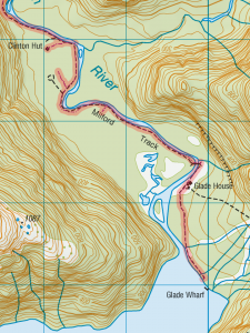
On topographical and geodetic maps, and PHP and JavaScript scripts for converting between the two

I’ve occasionally said in jest that the earth is flat, at least for the purposes of drawing small scaled maps, such as those that appear in the pages of this blog.
But what I’ve somehow missed up until now is that there are two types of flatness.
For everyone with a GPS machine, let’s see what you have got and what you are missing. Your machine will produce degrees east or west of the meridian and north or south of the equator. That’s called geodetic data, and it’s fine. That’s what the elevation data produced by the SRTM (Shuttle Radar Topography Mission) are mapped out as, it’s the data that GEOrgET works with.
But it’s not the data that mapmakers express themselves in. They deal in things called Transverse Mercator projections, and they function a little differently from taking one “square degree” and squishing it into approximately its physical dimensions. Starting from a reference longitude (the north-south line), they branch off at various latitudes, initially directly to the east or west and map out a rectangular grid. Can you see what is going to be off kilter here? The further south you go, the more the line you are following, the tangent (to the east or west) will deviate southwards from the arc of the latitude. In the same way true north starts to deviate (in the Southern Hemisphere) to the east or west corresponding to how far east or west of the reference longitude you are. Read more…
