If there was one word for this track, it would be “tough”, t, o, u g, h. It’s not just the two alpine passes that have to be conquered, nor the mud, nor even finding the track. It must be one of the toughest walks I’ve ever done. It’s pretty slow going at best, as the table shows, and the climbs and downclimbs reach an average grade of D+, which is between 7.5° and 15° on average for the distance of the climb. On average.
| Section | Distance | Track Time | Break | Mean speed | Median time|distance | Ascent | Descent |
| Lake Hauroko – Halfway Hut | 11.9 km | 4:35 h | 0:08 h | 2.60 km/h | 2.47|3.05 km/h | 444 m (M-) | 279 m (E+) |
| Halfway Hut – Lake Roe | 7.8 km | 3:58 h | 0:07 h | 1.95 km/h | 1.77|2.42 km/h | 643 m (M+) | 106 m (E) |
| Lake Roe – Loch Maree | 8.6 km | 4:19 h | 0:44 h | 1.98 km/h | 1.92|2.39 km/h | 419 m (D-) | 1245 m (D+) |
| Loch Maree – Supper Cove | 15.0 km | 6:39 h | 1:04 h | 2.25 km/h | 2.06|2.78 km/h | 505 m (M-) | 552 m (M-) |
| Supper Cove – Loch Maree | 14.1 km | 5:59 h | 0:55 h | 2.36 km/h | 2.21|2.90 km/h | 506 m (E+) | 452 m (M-) |
| Loch Maree – Kintail | 11.3 km | 5:22 h | 1:02 h | 2.11 km/h | 2.01|2.60 km/h | 563 m (M) | 341 m (M-) |
| Kintail – Upper Spey | 7.1 km | 4:26 h | 1:47 h | 1.60 km/h | 1.48|1.86 km/h | 833 m (D+) | 652 m (D) |
| Upper Spey – West Arm | 13.5 km | 4:39 h | 0:12 h | 2.90 km/h | 2.71|3.81 km/h | 275 m (E) | 547 m (M-) |
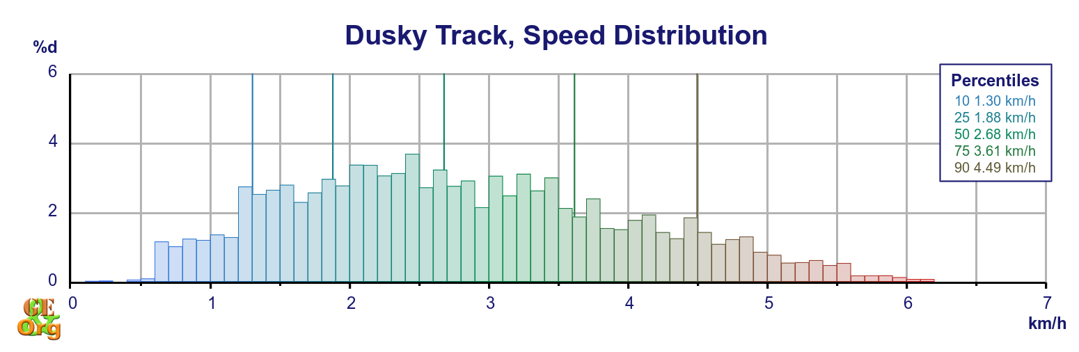
| Totals | 89.3 km | 39:58 h | 6:20 h | 2.23 km/h | 2.04|2.68 km/h | 4145 m (M) | 4134 m (M) |
| Summary of the Dusky Track. Climb categories are: Flat (< 1.9°/3.3%), Easy (> 1.9°/3.3%), Moderate (> 3.8°/6.6%), Demanding (> 7.5°/13%), Strenuous (> 15°/27%) | |||||||
Being up at Furkert Pass (Lake Roe) has one advantage: The lack of sandflies. On the other hand, the first day of any hike is bound to have its own organisational issues which need to be sorted before continuing on. A bit of daylight helps.
In any case, an easier second day to get to the top by around lunchtime means a free afternoon which – when the weather is good, as it was in my case – provides an opportunity to explore the wide open spaces. I only regret not having taken more and better photos, but my brain was out on jetlag. Again I would caution against hurrying on from here – if only for the views and the absent sandflies – because the downclimb is extreme. At many a point along the way I stood at the top of a rock and contemplated the further procedure. If the weather is bad at the top, it is probably better to stay there for the night, as the descent is best done with plenty of time, and preferably, in drier conditions.
About the only real savings can be achieved by leaving out the return trip to Supper Cove, although as this is the Dusky Track and Supper Cove is on the Dusky Sound, that for me is the whole point of the walk. Attempting the return trip in one day by dropping packs at Loch Maree could only be described as foolhardy. This is one of the longer stretches, and while fairly flat throughout has its own share of swamps that have to be negotiated. It might be possible to reach the mouth of the Seaforth by mid-afternoon and return, but I wouldn’t be taking any bets. Go to Supper Cove, take everything with you and spend a night there before coming back.
Up to Kintail there is a bit of climbing and some mud, but it is not so extreme. But from Kintail over Centre Pass is a real challenge. A pity that the weather wasn’t good on the day I passed through, because the views would have been amazing. And an excursion to Mt Memphis would have been worth it.
I had planned to spend the last night on the track but arriving so early into West Arm meant that I could take the early afternoon ferry and be at the motorcamp a day earlier than planned. In any case I had a full set of rations for the extra day, and if the weather had been bad then they might have been used. Arriving back in Te Anau in the afternoon has the advantage that the accommodation is ready to be moved into; an arrival before midday means hanging around until it is.
Slide Show
Trips&Tramps did a good job of getting us on to the track for the reasonable price of $149 per person. They also managed to set up contact between me and Jack, which turned out to be rather moot, but anyway. I had left off organising the ferry (to Manapouri) and bus (to Te Anau) until the last minute because of the vague possibility of kayaking back; I was told to purchase a ticket on arrival in Manapouri; in any case the return ticket is “open”, it didn’t require booking a specific date – you got on the boat when you got off the track. The bus to Te Anau was not necessary, as my friends of the last three days on the track offered to take me back in their car.
Reallocating meals. In general there was just enough food to cater for the calorific needs of a more sedentary lifestyle. Moving the fiddly bits – crackers, butter and cheese/salami – to breakfast time, and the (packaged) muesli bars to lunch meant that there were a few more calories before moving off, and that no major unpacking was necessary at lunch time, so I think this change will become permanent.
Sandflies. Deet worked well if applied at every opportunity. In general the huts were not great places for washing, so that some bites had to be endured. In these cases the topical anesthetic I had with me (polidocanol) worked well enough to get some sleep; and soaking the feet in the numerous swamps did its own good. Lake Roe Hut was almost sandfly-free, and if mosquito coils could be burned inside the huts (against the recommendations, but then the huts were be well aired) then fewer of them hung out.
The GPS track shows a couple of deviations from the official route, passing closer to the river after Hauroko Burn Hut, towards the mouth of the Seaforth River, and further along the Seaforth north of Loch Maree. Further notable detours are on the descent into Loch Maree from Lake Roe, just before Gair Loch, and on either side of Centre Pass. Nothing to get particularly worried about because you will be trying to follow the orange markers as much as possible.
All in all I can recommend doing the track in eight days, perhaps with an extra day to spare, just in case the going is tougher than expected. There were injuries on this trip, as well as kit being destroyed, and Nico becoming lost on the first day seems to indicate that he was not familiar with the track markers, which is an absolute must.
Topo Map with GPS Tracks